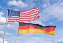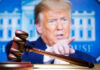
On Labor Day, President Trump posted a map that draped the American flag over Canada, Mexico, Greenland, and more—without a single word of explanation.
Story Snapshot
- Trump shared a map with the U.S. flag covering Canada, Mexico, Greenland, and other neighbors.
- The post carried no caption and labeled the whole area “United States of America” in the image.
- Several outlets described the map as altered or likely AI-generated.
- Foreign officials reacted, with Iceland lodging a formal complaint over inclusion on the map.
The Post That Redrew North America in One Image
President Trump used Truth Social on Monday, September 7, to share a striking image: a map showing the United States merged with Canada, Mexico, Greenland, and other nearby lands under a single flag. The post offered no caption, slogan, or context.
The image itself carried the label “United States of America” across the entire landmass, signaling a bold visual idea without a written claim. Multiple outlets reported a common core: the American flag overlay extended well beyond the lower forty-eight states.
People magazine listed Canada, Mexico, Greenland, Cuba, Guatemala, and more within the flag’s bounds, while others cited Iceland and parts of the Caribbean as included as well. The lack of a caption let the graphic do the work—and left room for others to define its meaning.
Trump posted a map with an American flag covering most of North America, as well as Iceland and islands in the Caribbean on Monday morning, a post that follows his previous pushes to take over territory outside of U.S. borders. https://t.co/wTh9WoY9LQ
— News 4 Buffalo (@news4buffalo) September 8, 2026
How Media and Diplomats Read the Signal
Coverage moved fast because the picture was clear and provocative. Several reports characterized the image as altered or likely made with artificial intelligence.
The state-run outlet Xinhua called it “apparently AI-generated,” a phrasing common in current reporting on synthetic visuals.
Ahram Online said the map appeared without further explanation, and noted that Iceland summoned the United States ambassador after finding its territory inside the flag’s sweep.
People’s report anchored the timing to Labor Day and detailed the countries shown inside the red, white, and blue overlay.
That specificity, repeated across outlets, narrowed debate to what the picture showed, not whether it existed. The single unresolved piece remains intent. The White House did not issue a formal explanation in the coverage cited. That silence let reactions fill the void.
What the Image Tapped: Power, Borders, and Ambiguity
The graphic touched bedrock issues—sovereignty, security, and national pride—without committing to a policy. That is a familiar tactic in modern political media. Research on synthetic and altered images shows that such visuals drive emotion, identity, and attention at low cost.
They spread fast in polarized spaces because each side sees what it wants to see, then rallies its own. Ambiguity is not a bug. It is the point: one image can be joke, warning, or wish, depending on the viewer.
Trump posted 37 times in one day: rename New Mexico “New America,” cover Canada, Mexico and Greenland with US flags on a map, and claim the Moon belongs to America. New Mexico’s governor: no. The state constitution: no. The Outer Space Treaty: also no.https://t.co/gqHueXeQSh
— VOCO News (@VOCOFMnews) September 8, 2026
From a common-sense lens, the reactions abroad were predictable and may even prove useful. Neighbors guard their borders; Americans guard theirs. When leaders test lines, allies show where they stand. That information has value.
The map asked a quiet question in a loud way: who respects American strength, and who flinches at its shadow? The answers arrived within hours, without a single official memo.
The Stakes: Not a Policy, but a Power Cue
Nothing in the reporting says this was a policy declaration. It was a post. Yet posts can steer agendas. The United States sits in a world where energy lanes, supply chains, and defense ties run through Canada, Mexico, Greenland, and the North Atlantic.
A single, memorable image can reset the week’s talk from tariffs and transit to territory and leverage. That shift alone shapes bargaining power, media focus, and what voters discuss at dinner.
The episode also fits a trend that analysts have tracked since 2024: leaders and movements use eye-catching synthetic visuals to mobilize supporters and keep critics reactive.
Studies of political images on platforms like X show a meaningful share are AI-generated, and they earn strong engagement because they compress complex ideas into one striking frame. That is the strategy here—compress, provoke, dominate the conversation.
Bottom Line: A Map, a Message, and Measurable Effect
Trump posted a map that pulled America’s neighbors under one flag. Newsrooms verified the picture’s basic features, and some called it likely AI-made. Diplomats noticed, and at least one government responded on the record.
The intent was unstated, but the effect was plain: the image set the terms. In modern politics, that is often enough. The medium does not just carry the message. The medium is the move.
One caution applies: coverage did not include the original post’s unique link or forensic details about the file. But the central facts of the image’s content and the official responses stand on named reporting. On that foundation, the story is simple. A picture crossed borders. So did the message.
Sources:
english.ahram.org.eg, people.com, english.news.cn